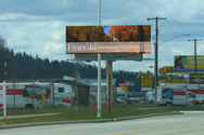
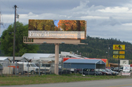
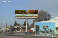
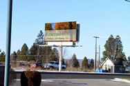
City: Post Falls (IDAHO)Billboard ID: 41Location Description: Seltice Way SL 600' e/o WellesleyDisplay Orientation: East Face / West FaceBillboard Size: 10' x 30'Traffic Count Per Day: Not RecordedDEC 18+: 9,177Illuminated: YesLatitude: 47.705777Longitude: -117.035213More Details Get A Quote
City: Post FallsBillboard ID: 40Location Description: Seltice Way SL 300' e/o WellesleyDisplay Orientation: East Face / West FaceBillboard Size: 10' x 30'Traffic Count Per Day: Not RecordedDEC 18+: 9,177Illuminated: YesLatitude: 47.704878Longitude: -117.036812 More Details Get A Quote
City: OakvilleBillboard ID: 215 A&BLocation Description: Hwy. 12 SL @ East City Limits Display Orientation: East Face / West FaceBillboard Size: 10' x 24'Traffic Count Per Day: Not RecordedDEC 18+: N/AIlluminated: YesLatitude: 46.840797Longitude: -123.229166More Details Get A Quote
City: East WenatcheeBillboard ID: 209 A&BLocation Description: Valley Mall Pkwy WL .5 miles n/o Grant Rd.Display Orientation: South Face / North FaceBillboard Size: 8' x 20'Traffic Count Per Day: Not RecordedDEC 18+: N/AIlluminated: YesLatitude: 47.4089219 Longitude: -120.289575 More Details Get A Quote
City: WenatcheeBillboard ID: 211 U&LLocation Description: N. Wenatchee Ave. EL at Duncan Rd.Display Orientation: South Face / South FaceBillboard Size: 8' x 16'Traffic Count Per Day: Not RecordedDEC 18+: N/AIlluminated: YesLatitude: 47.454667Longitude: -120.335944More Details Get A Quote
City: BrewsterBillboard ID: 205 ALocation Description: Hwy. 97 WL at North City LimitsDisplay Orientation: South FaceBillboard Size: 8' x 20'Traffic Count Per Day: Not RecordedDEC 18+: UndefinedIlluminated: YesLatitude: 48.105903Longitude: -119.779350More Details Get A Quote
City: OkanoganBillboard ID: 204 A&BLocation Description: Hwy. 97 WL 300' s/o City Center Exit.Display Orientation: South Face / North FaceBillboard Size: 12' x 24'Traffic Count Per Day: Not RecordedDEC 18+: N/AIlluminated: YesLatitude: 48.34953 Longitude: -119.5909582 More Details Get A Quote
City: OrovilleBillboard ID: 201 A&BLocation Description: Hwy. 97 WL .5 miles s/o Canadian Border.Display Orientation: North Face / South FaceBillboard Size: 14' x 48'Traffic Count Per Day: Not RecordedDEC 18+: N/AIlluminated: YesLatitude: 48.988274Longitude: -119.456384More Details Get A Quote
City: OmakBillboard ID: 202 A&BLocation Description: Hwy. 97 EL .5 miles s/o North Omak ExitDisplay Orientation: North Face / South FaceBillboard Size: 10' x 24'Traffic Count Per Day: Not RecordedDEC 18+: N/AIlluminated: YesLatitude: 48.408286Longitude: -119.515746More Details Get A Quote
City: OmakBillboard ID: 203 A&BLocation Description: Hwy. 97 EL .5 miles s/o City Center Exit. Just south of Omak.Display Orientation: North Face / South FaceBillboard Size: 10' x 24'Traffic Count Per Day: Not RecordedDEC 18+: N/AIlluminated: YesLatitude: 48.401656Longitude: -119.524068More Details Get A Quote
City: EphrataBillboard ID: 208 AU & ALLocation Description: Hwy. 281 SL 100' e/o Jct. 28.Display Orientation: West FaceBillboard Size: 8' x 16'Traffic Count Per Day: Not RecordedDEC 18+: N/AIlluminated: YesLatitude: 47.308392 Longitude: -119.559318 More Details Get A Quote
City: EphrataBillboard ID: 207 BU & BL - 207 AU & ALLocation Description: Hwy. 281 South Lane 1 Mile West of EphrataDisplay Orientation: East Face / East FaceBillboard Size: 10' x 20'Traffic Count Per Day: Not RecordedDEC 18+: N/AIlluminated: YesLatitude: 47.292738Longitude: -119.571798 More Details Get A Quote
City: WilburBillboard ID: 214 A&BLocation Description: Hwy. 2 NL 500' e/o Hwy. 174 Jct.Display Orientation: West Face / East FaceBillboard Size: 10' x 24'Traffic Count Per Day: Not RecordedDEC 18+: N/AIlluminated: YesLatitude: 47.756616Longitude: -118.70628More Details Get A Quote
City: CashmereBillboard ID: 212BLocation Description: Location Description: Hwy. 2 NL 1000' e/o City Center ExitDisplay Orientation: East FaceBillboard Size: 10' x 30'Traffic Count Per Day: Not RecordedDEC 18+: N/AIlluminated: YesLatitude: 47.529952 Longitude: -120.493102 More Details Get A Quote
City: Soap LakeBillboard ID: 206 A&BLocation Description: Hwy. 17 EL @ N City LineDisplay Orientation: North Face / South FaceBillboard Size: 8' x 20'Traffic Count Per Day: Not RecordedDEC 18+: N/AIlluminated: YesLatitude: 47.391169 Longitude: -119.4821774 More Details Get A Quote
City: WenatcheeBillboard ID: 210 ALocation Description: 404 S. Mission. Heavily traveled artery on one-way leading to East Wenatchee.Display Orientation: South FaceBillboard Size: 8' x 20'Traffic Count Per Day: Not RecordedDEC 18+: N/AIlluminated: YesLatitude: 47.418827Longitude: -120.308742More Details Get A Quote
City: DrydenBillboard ID: 213 A&BLocation Description: Hwy. 2 NL 1100' East of Jct. 97Display Orientation: West Face / East FaceBillboard Size: 10' x 30'Traffic Count Per Day: Not RecordedDEC 18+: N/AIlluminated: YesLatitude: 47.552462 Longitude: -120.60457 More Details Get A Quote
City: SpokaneBillboard ID: 13 A&BLocation Description: Trent SL @ Byrd.Display Orientation: East Face / West FaceBillboard Size: 14' x 48'Traffic Count Per Day: 20,873DEC 18+: 16,388Illuminated: YesLatitude: 47.6736941 Longitude: -117.3358823 More Details Get A Quote
City: SpokaneBillboard ID: 14 A&BLocation Description: Trent NL @ Lily.Display Orientation: West Face / East FaceBillboard Size: 14' x 48'Traffic Count Per Day: 23,820DEC 18+: 13,266Illuminated: YesLatitude: 47.676581 Longitude: -117.307251 More Details Get A Quote
City: SpokaneBillboard ID: 11 A&BLocation Description: Trent & Freya. SWC.Display Orientation: South Face / North FaceBillboard Size: 14' x 48'Traffic Count Per Day: 19,600DEC 18+: 17,633Illuminated: YesLatitude: 47.668517Longitude: -117.359459More Details Get A Quote
City: SpokaneBillboard ID: 21 A&BLocation Description: Sullivan EL @ Valleyway.Display Orientation: North Face / South FaceBillboard Size: 14' x 48'Traffic Count Per Day: 33,861DEC 18+: 20,068Illuminated: YesLatitude: 47.6600032Longitude: -117.1964921More Details Get A Quote
City: SpokaneBillboard ID: 23Location Description: Stevens & 2nd NEC. North face approach is visible to commuters traveling through popular SoDo district, east face has traffic leading to medical offices, South Hill residential and I-90 on-ramps.Display Orientation: North Face / East FaceBillboard Size: 10' x 30'Traffic Count Per Day: Not RecordedDEC 18+: 15,470Illuminated: YesLatitude: 47.654641Longitude: -117.4195More Details Get A Quote
City: SpokaneBillboard ID: 38 A&BLocation Description: Sprague w/o Gillis.Display Orientation: East Face / West FaceBillboard Size: 10' x 30'Traffic Count Per Day: 25,456DEC 18+: 16,630Illuminated: YesLatitude: 47.656883 Longitude: -117.2570953 More Details Get A Quote
City: SpokaneBillboard ID: 18Location Description: Sprague NL w/o Farr.Display Orientation: East FaceBillboard Size: 14' x 48'Traffic Count Per Day: 25,462DEC 18+: 19,163Illuminated: YesLatitude: 47.657413 Longitude: -117.275725 More Details Get A Quote
City: SpokaneBillboard ID: 16Location Description: Sprague NL w/o Vista.Display Orientation: East FaceBillboard Size: 14' x 48'Traffic Count Per Day: 29,838DEC 18+: 27,244Illuminated: YesLatitude: 47.6572869 Longitude: -117.295246 More Details Get A Quote
City: SpokaneBillboard ID: 39 A&BLocation Description: Sprague NL e/o Blake.Display Orientation: East Face / West FaceBillboard Size: 10' x 30'Traffic Count Per Day: 28,205DEC 18+: 16,736Illuminated: YesLatitude: 47.657462Longitude: -117.222521More Details Get A Quote
City: SpokaneBillboard ID: 17 A&BLocation Description: Sprague & WillowDisplay Orientation: 17 A&BBillboard Size: 14' x 48'Traffic Count Per Day: 25,462DEC 18+: 17,529Illuminated: YesLatitude: 47.657029Longitude: -117.277962More Details Get A Quote
City: SpokaneBillboard ID: 20 A&BLocation Description: Sprague & McCabe NWC.Display Orientation: East Face / West FaceBillboard Size: 14' x 48'Traffic Count Per Day: 28,205DEC 18+: 16,736Illuminated: YesLatitude: 47.657191Longitude: -117.225578More Details Get A Quote
City: SpokaneBillboard ID: 22Location Description: Ruby WL s/o SharpDisplay Orientation: South FaceBillboard Size: 12' x 24'Traffic Count Per Day: 37,562DEC 18+: 27,531Illuminated: YesLatitude: 47.6689923Longitude: -117.4095325More Details Get A Quote
City: SpokaneBillboard ID: 19 A&BLocation Description: Pines EL @ Olive St.Display Orientation: North Face / South FaceBillboard Size: 14' x 48'Traffic Count Per Day: 21,378DEC 18+: 17,188Illuminated: YesLatitude: 47.660857Longitude: -117.23976More Details Get A Quote
City: SpokaneBillboard ID: 3 A&BLocation Description: Northwest Blvd. NL @ Elm.Display Orientation: West Face / East FaceBillboard Size: 14' x 48'Traffic Count Per Day: 20,700DEC 18+: 16,912Illuminated: YesLatitude: 47.68089Longitude: -117.439664More Details Get A Quote
City: SpokaneBillboard ID: 32Location Description: Nevada EL n/o Lincoln Rd NF - Spokane, WADisplay Orientation: North FaceBillboard Size: PosterTraffic Count Per Day: Not RecordedDEC 18+: 12,258Illuminated: YesLatitude: 47.7289111Longitude: -117.3954163More Details Get A Quote
City: SpokaneBillboard ID: 31 A&BLocation Description: Nevada & Magnesium.Display Orientation: South Face / North FaceBillboard Size: 10' x 30'Traffic Count Per Day: 16,456DEC 18+: 12,258Illuminated: YesLatitude: 47.736244Longitude: -117.3954163More Details Get A Quote
City: SpokaneBillboard ID: 34Location Description: Nevada & Lincoln SEC / SFDisplay Orientation: South FaceBillboard Size: PosterTraffic Count Per Day: 17,045DEC 18+: 12,455Illuminated: YesLatitude: 47.728967Longitude: -117.395249More Details Get A Quote
City: SpokaneBillboard ID: 33Location Description: Nevada & Lincoln NECDisplay Orientation: North FaceBillboard Size: PosterTraffic Count Per Day: Not RecordedDEC 18+: 12,258Illuminated: YesLatitude: 47.730026Longitude: -117.3949More Details Get A Quote
City: SpokaneBillboard ID: 35 A&BLocation Description: Nevada & Francis.Display Orientation: North Face / South FaceBillboard Size: 10' x 30'Traffic Count Per Day: 22,365DEC 18+: 14,421Illuminated: YesLatitude: 47.715989Longitude: -117.395278More Details Get A Quote
City: SpokaneBillboard ID: 30Location Description: N 10010 Nevada South StructureDisplay Orientation: North Face / South FaceBillboard Size: 10' x 30'Traffic Count Per Day: Not RecordedDEC 18+: 11,012Illuminated: YesLatitude: 47.748457Longitude: -117.39516More Details Get A Quote
City: SpokaneBillboard ID: 37 A&BLocation Description: Market & Glass.Display Orientation: South Face / North FaceBillboard Size: 10' x 30'Traffic Count Per Day: 25,100DEC 18+: 16,715Illuminated: YesLatitude: 47.69121Longitude: -117.365083More Details Get A Quote
City: SpokaneBillboard ID: 29Location Description: N 10010 Nevada North StructureDisplay Orientation: North Face / South FaceBillboard Size: 10' x 30'Traffic Count Per Day: Not RecordedDEC 18+: 11,012Illuminated: YesLatitude: 47.748457Longitude: -117.39516More Details Get A Quote
City: SpokaneBillboard ID: 9 A&BLocation Description: Market WL n/o Lincoln Rd.Display Orientation: South Face / North FaceBillboard Size: 14' x 48'Traffic Count Per Day: 20,004DEC 18+: 10,525Illuminated: YesLatitude: 47.7311832 Longitude: -117.36472 More Details Get A Quote
City: SpokaneBillboard ID: 10 A&BLocation Description: Market EL. s/o Euclid.Display Orientation: North Face / South FaceBillboard Size: 14' x 48'Traffic Count Per Day: 25,100DEC 18+: 16,715Illuminated: YesLatitude: 47.685457Longitude: -117.3651More Details Get A Quote
City: SpokaneBillboard ID: 2Location Description: Maple EL @ SharpDisplay Orientation: South FaceBillboard Size: 14' x 48'Traffic Count Per Day: 33,500DEC 18+: 18,223Illuminated: YesLatitude: 47.668639 Longitude: -117.4353 More Details Get A Quote
City: SpokaneBillboard ID: 25 A&BLocation Description: Indiana & Washington.Display Orientation: East Face / West FaceBillboard Size: 10' x 30'Traffic Count Per Day: 15,461DEC 18+: 14,355Illuminated: YesLatitude: 47.674931Longitude: -117.416591More Details Get A Quote
City: SpokaneBillboard ID: 1 A&BLocation Description: Hwy 2 / Sunset Hwy. SL @ Rustle Rd.Display Orientation: East Face / West FaceBillboard Size: 14' x 48'Traffic Count Per Day: 22,365DEC 18+: 15,732Illuminated: YesLatitude: 47.6431313 Longitude: -117.5272612 More Details Get A Quote
City: SpokaneBillboard ID: 7Location Description: Division WL s/oShannon.Display Orientation: North FaceBillboard Size: 14' x 48'Traffic Count Per Day: 34,762DEC 18+: 32,775Illuminated: YesLatitude: 47.6756659 Longitude: -117.4113913 More Details Get A Quote
City: SpokaneBillboard ID: 12 A&BLocation Description: Freya & Ferry. SECDisplay Orientation: North Face / South FaceBillboard Size: 14' x 48'Traffic Count Per Day: 19,600DEC 18+: 17,633Illuminated: YesLatitude: 47.6607287 Longitude: -117.3574739 More Details Get A Quote
City: SpokaneBillboard ID: 26Location Description: Francis NL w/o Calispel NECDisplay Orientation: West Face / East FaceBillboard Size: 10' x 30'Traffic Count Per Day: Not RecordedDEC 18+: 19,731Illuminated: YesLatitude: 47.715126Longitude: -117.415684More Details Get A Quote
City: SpokaneBillboard ID: 8 A&BLocation Description: Francis NL @ Cincinnati.Display Orientation: West Face / East FaceBillboard Size: 14' x 48'Traffic Count Per Day: 19,700DEC 18+: 15,863Illuminated: YesLatitude: 47.715102Longitude: -117.396649More Details Get A Quote
City: SpokaneBillboard ID: 36 A&BLocation Description: Francis & Perry.Display Orientation: East Face / West FaceBillboard Size: 10' x 30'Traffic Count Per Day: 16,450DEC 18+: 15,404Illuminated: YesLatitude: 47.715154Longitude: -117.391858More Details Get A Quote
City: SpokaneBillboard ID: 28Location Description: Division WL s/o GravesDisplay Orientation: South Face / North FaceBillboard Size: 10' x 30'Traffic Count Per Day: Not RecordedDEC 18+: 17,109Illuminated: YesLatitude: 47.747036Longitude: -117.411455More Details Get A Quote
City: SpokaneBillboard ID: 5 A&BLocation Description: Division EL. n/oLincoln Rd.Display Orientation: North Face / South FaceBillboard Size: 14' x 48'Traffic Count Per Day: 30,086DEC 18+: 27,531Illuminated: YesLatitude: 47.732336Longitude: -117.41124More Details Get A Quote
City: SpokaneBillboard ID: 6 A&BLocation Description: Division & Gordon.Display Orientation: North Face / South FaceBillboard Size: 14' x 48'Traffic Count Per Day: 35,633DEC 18+: 26,417Illuminated: YesLatitude: 47.6905439 Longitude: -117.4108871 More Details Get A Quote
City: SpokaneBillboard ID: 27 A&BLocation Description: Country Homes Blvd. w/o Division.Display Orientation: East/West FaceBillboard Size: 10' x 30'Traffic Count Per Day: 24,738DEC 18+: 14,737Illuminated: YesLatitude: 47.7403396 Longitude: -117.4134685More Details Get A Quote
City: SpokaneBillboard ID: 43 A&BLocation Description: Buckeye e/o Astor.Display Orientation: East Face / West FaceBillboard Size: 5' x 10'Traffic Count Per Day: 9,200DEC 18+: 7,394Illuminated: YesLatitude: 47.6825878 Longitude: -117.4051953 More Details Get A Quote
City: SpokaneBillboard ID: 42 A&BLocation Description: Buckeye & Astor.Display Orientation: East Face / West FaceBillboard Size: 5' x 10'Traffic Count Per Day: 9,200DEC 18+: 7,394Illuminated: YesLatitude: 47.6826076 Longitude: -117.4041929 More Details Get A Quote